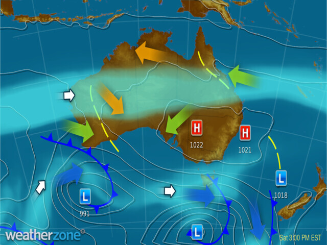
The key ingredients for fog are moisture, light winds, and clear skies. These conditions often occur with a high-pressure system during winter like the one centred over NSW today. This high will help to produce conditions favourable for fog across eastern parts of NSW, the ACT, Qld, and Vic from now to Tuesday morning.

Image: MSLP chart for 3pm AEST Saturday 10th June.
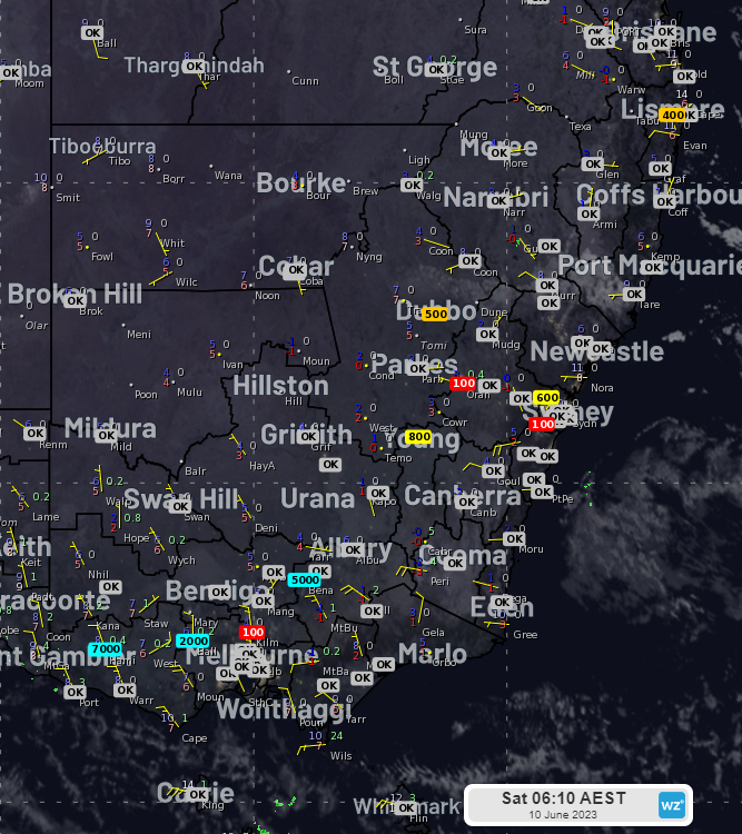
Early this morning, the high moved in and helped to produce a chilly morning with patches of fog appearing in some locations. Visibility dropped to 100m at the Kilmore Gap and Bendigo in Vic, Maryborough and Rockhampton in Qld and Richmond and Camden in Sydney’s west.

Image: Himawari-9 infrared satellite imagery with overlayed visibility (m) at 6:10am AEST 10th June.
Tomorrow morning, fog is a chance over a larger number of locations, stretching from northern and eastern Vic, through central and eastern NSW and the ACT, up to southeast Qld, with a chance for Canberra and Brisbane. The winds over Sydney today are blowing offshore and reducing moisture, but there may be some fog in the west as we saw this morning.
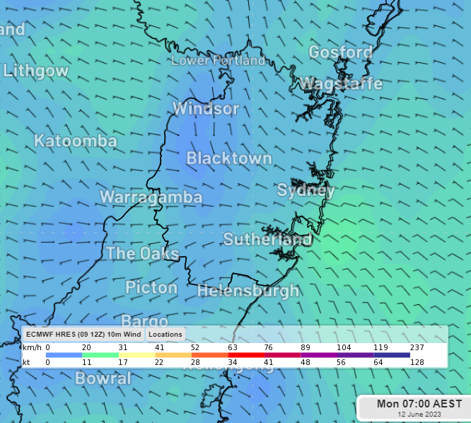
Monday morning will see the chance of fog over similar areas, including Canberra and Brisbane as well as Sydney. This will be a better chance to see Sydney Harbour shrouded in some fog because the moisture will increase during Sunday with onshore winds. Fog will likely form in Sydney’s west and can then be carried eastward toward the harbour with light winds.

Image: 10-m winds (showing light westerly winds over Greater Sydney) at 7am AEST on Monday 12th June (ECMWF model).
On Tuesday, the chance of fog should largely contract to northeast NSW and eastern Qld as a cold front begins to move across southeast Australia and increases cloud cover and wind speeds.
