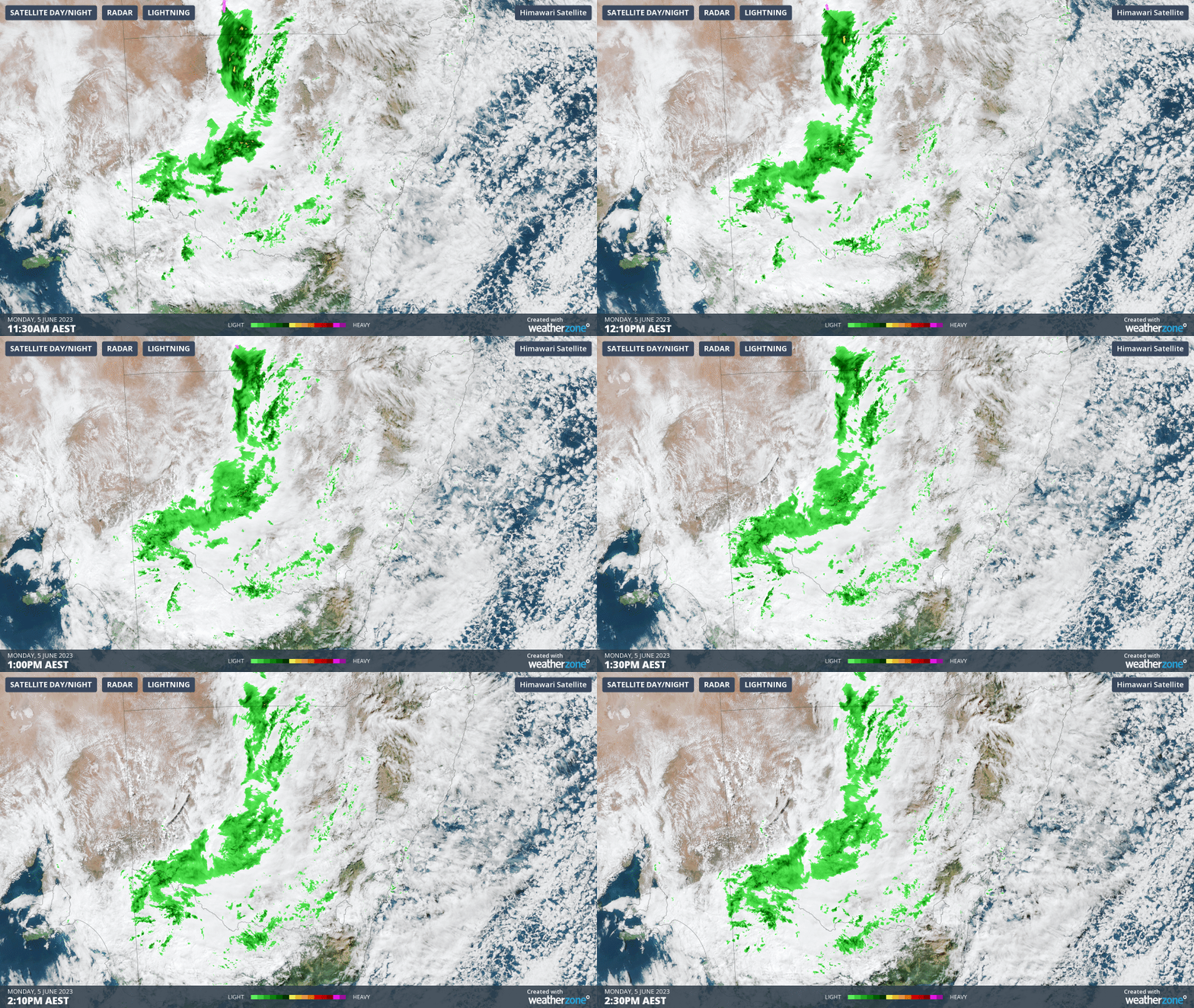
Welcome winter rain has fallen in parts of four states that are normally pretty dry in winter as a trough crosses the region.
It’s still raining on the western plains as we write this story on Monday afternoon, with more to come later this week. But for now, significant falls have already been recorded in:
- Southwest Qld
- Western and central NSW
- Far northwestern Vic
- Parts of outback South Australia
The heaviest overnight reading in this vast inland area to 9 am Monday was 50 mm at Winnathee Station, a remote sheep and cattle property on the NSW/SA border.
To put that 50 mm total in perspective, it almost equalled the record for the wettest (entire month of) June in the nearby town of Tibooburra.
Other places in far western NSW topped a very handy 20 mm to 9 am Monday, including the aforementioned Tibooburra itself, as well as Broken Hill which had its wettest June day in 15 years.

Nowhere in Vic or SA quite topped the 20 mm mark, but there were still plenty of useful overnight falls of 10 mm or slightly more. And as you can see on the loop above, the falls have continued into Monday.
This is just the first phase of a system which will deliver yet more inland rain to the eastern states this week.
Further troughs ahead of a cold front are due to cross the inland later this week That’ll again mean widespread heavy rain, with Wednesday looking like the wettest day in large towns like Broken Hill (NSW) and Mildura (VIC), before the rain moves east and impacts virtually all of Victoria and southern NSW later on Wednesday and into Thursday.
