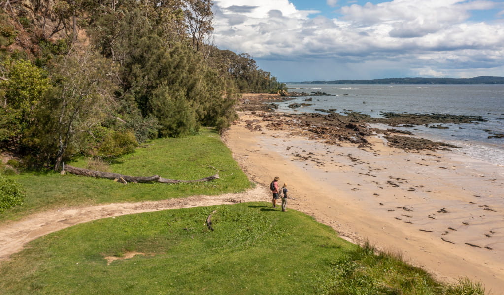
The National Parks and Wildlife Service says the informal access road to Maloneys Beach has been closed, but there are now similar facilities in place for the public to use instead. Photo: NSW NPWS.
Authorities have defended their decision to close informal access to a South Coast beach, describing it as “not sustainable or safe”.
The Murramarang South Coast Walk ran from north of Batemans Bay to Kiola, north of Ulladulla. It started at Pretty Beach and ended at Maloneys Beach and was officially opened to self-guided treks on 28 April.
The decision to close unofficial road access to the latter has drawn the ire of some locals, but others say it followed a well-publicised process in the development of the Coast Walk.
A spokesperson for the NSW National Parks and Wildlife Service (NPWS) said this process ”included an upgrade to the Maloneys Beach visitor precinct to improve public amenity and safety”.
The informal access had caused environmental damage to the site, the spokesperson said.
“The old informal vehicle track was not paved nor formally recognised as a boat ramp, and over time vehicle use had caused damage and vegetation loss to the dunes.
“The masterplan identified that vehicle access along the informal road was not sustainable or safe and so bollards were installed to limit vehicle access along the informal pathway.”
According to the 2021 Murramarang South Coast Walk Master Plan document, Maloneys Beach had become “degraded over time due to uncontrolled vehicle access to the grassy foreshore, foredune and beach. This is not permitted under the [Murramarang National Park’s] statutory plan of management.
“Vehicle access has also led to illegal camping and human waste disposal, littering, and uncontained fires.”
The NPWS spokesperson said Maloneys Beach residents and visitors could use similar facilities to access the water.
“The masterplan for Maloney’s Beach includes new access arrangements with a new road and carpark and the closure of the informal access road,” the spokesperson said.
“NPWS has recently installed the new carparking facilities and formal pathways to the beach that don’t impact the environmental values of the park and provide better access for launching kayaks and canoes into the shallow water.”
A spokesperson for the Maloneys Beach Residents Association (MBRA) said the closure followed community consultation.
“The NPWS stated that while the informal beach access had been there for many years, even preceding the gazetting of the national park, the NPWS has no ability within its controlling legislation to include a boat ramp in any national park,” the MBRA spokesperson said.
“The NPWS was determined from the beginning to close all vehicle access to the beach.”
The masterplan’s development followed meetings between community groups and National Parks, and the opportunity for public feedback, the MBRA spokesperson said.
“The developments in the national park, even though they have not necessarily met residents’ expectations, have not happened in a vacuum and concessions were made by all sides.
“The informal dirt track that has now been closed off and grassed was, and still is, on ESC [Eurobodalla Shire Council] land.
“There was some discussion about providing beach access from this track via a boat ramp in the same place where the army had built one for an exercise in the past.
“This was rejected by ESC as current legislation does not allow for the provision of informal boat ramps.”
