By Tim Rowland
Item: This is the worst black fly season in at least 16 years.
I’m not possessed of this kind of historical record myself, but I saw it on social media, so it must be true. There have also been anecdotal reports from the field of black fly swarms terrorizing hikers, ruining picnics and, although details are sketchy, possibly trying to open an STR.

I do have some direct experience based on a recent hike along with Explorer writer/photographer Mike Lynch on Jones Hill in the Town of Schroon. There, the bugs were as bad as advertised, and while black flies find me generally distasteful, they occasionally will take a bite and spit out.
Worse, they were so thick that it was difficult not to inhale them, making the choice of whether to breathe through your nose or your mouth more meaningful, but not in a pleasant way.
According to a contractor who treats streams for black flies, as quoted in town of Wilmington Supervisor Roy Holzer’s weekly report: “The mild winter didn’t freeze many of the smaller streams, allowing the larvae that winter over in the streams to survive. Usually the smaller streams don’t need treatment in the first round. The constant high water made for (good) habitat. Also, to top it all off, the wind blew hard for three weeks bringing adult flies into the treatment area. Having all three weather events happen in the same year has led to an unprecedented number of black flies in treatment areas.”
Knowing none of this at the time, Mike and I left a car in the Dirgylot trailhead on Route 9 north of Schroon Lake, then drove to the Big Pond trailhead on Hoffman Road on the south end of town for a traverse of Jones Hill, which despite its modest name and sub-2,000-foot elevation has some inspiring views that get better and better as you ascend its ridge line from the south.
The trail isn’t official yet, but it will eventually become part of the North Country Scenic Trail that is to span half the country. Meantime, it’s pretty easy to follow even though it’s unmarked — you don’t have to be a bushwhacker, but it helps to have a good set of trail and topographical instincts.
If you’re doing an out-and-back, the southern segment is the best option. Follow the trail to Big Pond for about a mile to a point where there’s a little dip in the footpath. At the top of the rise out of the dip, be alert for a trail breaking off to the right.
The dark tread was easy to follow (it almost appeared to have been recently swept) to a bridge over the outlet to North Pond, where it then climbs moderately up the flank of a small hill to avoid the wetlands below. After this detour to the east, the route fishhooks back to the west about two miles into the hike and heads to the southern ridge of Jones.
The climb is steep but not overly so, and pretty soon the rewards begin, including an unparalleled view of Pharaoh Mountain to the east. We climbed further to the next overlook and discovered why the trail looked so well-maintained: Trail steward Bill Herman and his partner Jim Geiger were descending with rakes and some debris from an old illegal hunting camp near the summit.
Despite its unofficial status, they said the trail is getting more use (it even shows up on some online trail maps like Mapcarta) as hikers discover its prodigious payoffs. It was hard to tell who enjoyed the conversation more, us or the black flies who were appreciative of the stationary targets.
The were literally coming at us in clouds, and reminded me of a passage in Adirondack Murray’s 19th century travelog, in which he dismissed black flies as no big deal, and then suggested wearing a counteractive outfit that would be familiar to anyone who has witnessed the cleanup of a toxic-waste dump.

As Mike and I approached the summit we passed the old camp and each dutifully picked up some trash to pack out — but not the iron woodstove that must have been carried up by Atlas himself.
The view at the top, reached in four miles, is dominated by Hoffman Mountain, a handsome cone on a long ridge to the west. Some High Peaks were distant in the North and Gore to the south, along with an interesting view of the ridge we had just climbed.
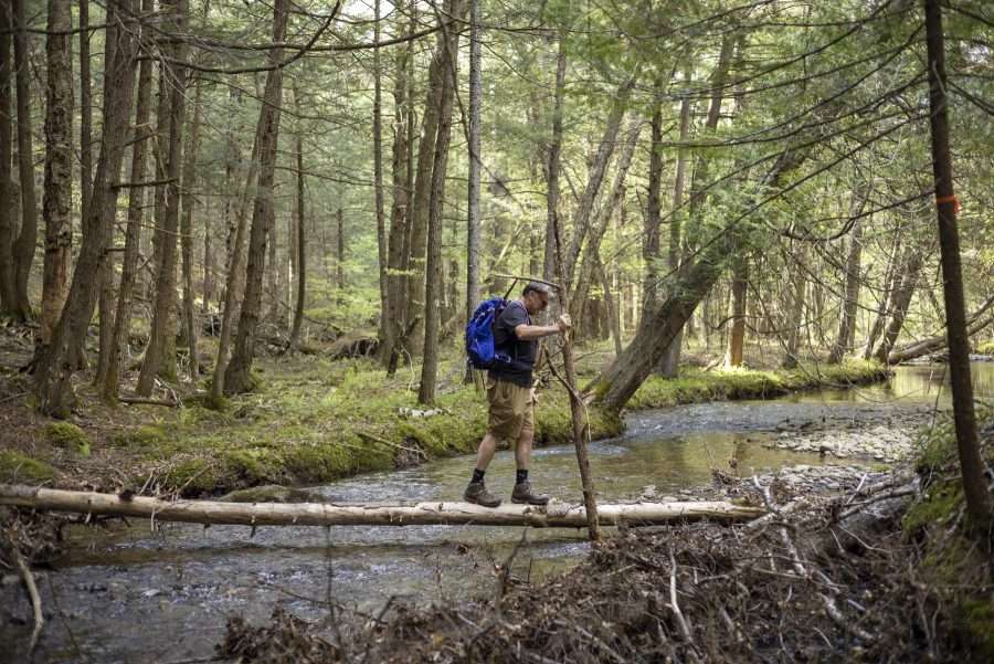
Instead of turning around, we soldered on toward Dirgylot to the north on a route that has been flagged and sketched out, but is not as easy to follow and includes a challenging water crossing. On the far side of the brook, the trail, such as it is, turns right on an old road and after a short distance peels off to the left climbing the flank of Smith Hill and then remaining mostly level until it reaches another road at just over six miles.
Turning left on the road we followed it to where it intersected with a road coming in from the right. It is not marked, but identifiable by a leaning white birch pointing the way. This road will lead to a high culvert under the Northway. Interestingly, the bugs didn’t follow us in. Who knew that black flies were afraid of the dark?
Exiting the tubes, turn right on another road and follow it to the parking lot, reached in seven miles. Although the northern segment is a mile shorter, at this point I would only recommend it to people who are comfortable off-trail. Hopefully that will soon change, at which point this hike seems sure to become one of the more attractive adventures in the Eastern Adirondacks, black flies or no.
Jones Hill traverse
- Distance: 7 miles
- Summit elevation: 1,868
- Elevation gain: 1,082
